Overline Surveys
Close Interval Potential Surveys
R & R Corrosion Ltd provides Close Interval Potential Surveys (CIPS) using our specialist NEXUS data-logging system. Developed specifically for cathodic protection surveys, NEXUS allows pipeline potentials and positional information to be collected accurately and efficiently along the complete survey route.
During the survey, an engineer walks the pipeline route while the NEXUS data logger records structure-to-electrolyte potentials at close intervals. A trailing wire maintains the electrical connection to the pipeline, while a calibrated reference electrode provides contact with the soil directly above or close to the pipeline.
When used with the PULSAR GPS-synchronised current interrupters, the NEXUS system records both CP system ON and instant-OFF potentials. The instant-OFF measurements reduce the effect of voltage drop through the soil and provide a more representative indication of the pipeline’s polarised potential.
The NEXUS system provides:
- Simultaneous recording of ON and instant-OFF potentials
- GPS-referenced survey measurements
- Accurate synchronisation with the Pulsar current interrupters
- Continuous data collection along the pipeline route
- Recording of test posts, road crossings, valves and other features
- Field identification of abnormal or non-compliant readings
- Secure storage and transfer of survey data
- Efficient processing and analysis of large datasets
- Production of detailed potential profiles and survey plots
- Comparison with previous surveys and historical results
NEXUS survey data is processed and analysed by R & R Corrosion’s experienced engineers to identify under protected or overprotected areas, changes in current distribution, possible interference and locations requiring further investigation.
CIPS can also be combined with DCVG, ACVG, depth-of-cover and coating-condition surveys to provide a more complete assessment of pipeline integrity.
Following completion, R & R Corrosion provides a detailed technical report containing the survey methodology, potential profiles, GPS-referenced results, identified anomalies and practical recommendations. By using our own NEXUS data-logging technology, we can provide clients with an integrated CIPS service covering equipment, field survey, specialist analysis and reporting.
Alternating Current Voltage Gradient
R & R Corrosion Ltd provides Alternating Current Voltage Gradient (ACVG), also known as Pearson, surveys to locate defects in the protective coating of buried pipelines.
A controlled AC signal is applied to the pipeline using a transmitter connected at a suitable test point. The signal escapes into the surrounding soil at coating defects, producing a measurable voltage gradient at ground level. An engineer follows the pipeline route using two earth-contact electrodes connected to a sensitive receiver, identifying changes in signal strength and polarity to locate each defect.
Our ACVG/Pearson surveys can include:
- Confirmation and tracking of the pipeline route
- Detection of coating holidays and areas of coating deterioration
- Accurate location and GPS recording of defects
- Identification of small or closely spaced indications
- Adjustment of survey sensitivity to suit soil and coating conditions
- Recording of test posts, crossings, valves and other pipeline features
- Comparison with previous surveys and coating-repair records
- Marking defect locations for excavation or further investigation
- Integration with CIPS, DCVG and depth-of-cover results
Where suitable, R & R Corrosion can use the NEXUS data-logging system to record GPS positions, survey observations, pipeline features and identified defect locations. This provides a consistent and traceable dataset for analysis and reporting.
ACVG is particularly useful where CP current interruption is unavailable or where a rapid coating-defect location survey is required. However, signal response can be affected by soil resistivity, pipeline depth, electrical continuity, interference and the configuration of the applied signal. Survey settings and methods are therefore selected to suit the individual pipeline and site conditions.
Following completion, R & R Corrosion provides a detailed report containing the survey methodology, equipment settings, GPS-referenced defect locations, route information, findings and recommended follow-up work. This enables clients to plan targeted excavations, coating repairs and additional integrity investigations.
Direct Current Voltage Gradient
R & R Corrosion Ltd provides Direct Current Voltage Gradient (DCVG) surveys to locate and assess defects in the protective coating of buried pipelines.
When cathodic protection current flows onto a pipeline at a coating defect, it creates a voltage gradient in the surrounding soil. During a DCVG survey, an engineer walks the pipeline route using two calibrated reference electrodes connected to specialist survey equipment. Measurements of the voltage gradient indicate the direction of current flow and allow the coating defect to be accurately located.
Pulsar GPS-synchronised current interrupters are installed on the relevant cathodic protection systems to produce a clearly defined ON and OFF cycle. This enables the engineer to distinguish the pipeline’s voltage gradient from other electrical activity in the surrounding environment.
Our DCVG surveys can include:
- Accurate identification and GPS positioning of coating defects
- Determination of the direction of CP current flow
- Assessment of defect severity and relative importance
- Calculation of percentage IR values where suitable reference measurements are available
- Identification of possible anodic or corrosive conditions
- Investigation of previously reported defects
- Recording of test posts, crossings, valves and pipeline features
- Comparison with earlier surveys and repair records
- Prioritisation of defects for excavation or further assessment
R & R Corrosion can use the NEXUS data-logging system to record survey measurements, positional information and pipeline features efficiently in the field. The collected data can be combined with CIPS, ACVG, depth-of-cover and coating-assessment results to provide amore complete understanding of coating condition and cathodic protection performance.
Following completion, we provide a detailed report containing the survey methodology, route information, GPS-referenced defect locations, severity assessment, survey plots and recommended follow-up actions. This allows clients to prioritise excavations and coating repairs based on the significance of the identified defects.
Inshore Trailing Wire - River Crossing Surveys
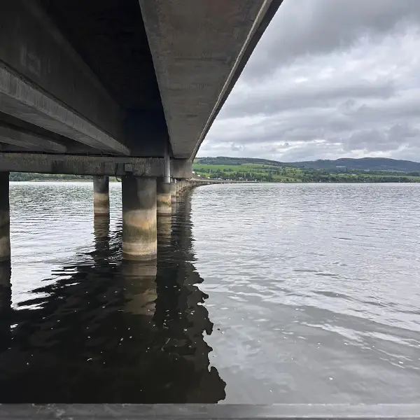
R & R Corrosion Ltd provides inshore trailing-wire and river-crossing surveys to assess cathodic protection performance on submerged, buried or otherwise inaccessible pipeline sections.
These surveys are particularly suitable for pipeline landfalls, estuaries, rivers, harbours, outfalls and other locations where conventional land-based CIPS measurements cannot be completed.
For a trailing-wire survey, an electrical connection is made to the pipeline at a suitable test point or landfall. A specialist, insulated trailing wire maintains this connection as the survey team follows the pipeline route by boat or from the riverbank. A calibrated marine reference electrode is positioned close to the pipeline, allowing structure-to-electrolyte potentials to be measured at regular intervals.
Our services can include:
- Continuous or close-interval potential measurements
- ON and instant-OFF potential surveys
- GPS-synchronised interruption of relevant CP current sources
- GPS-referenced recording of measurements
- Surveying of pipeline landfalls and river crossings
- Confirmation of pipeline alignment and crossing location
- Assessment of CP current distribution and attenuation
- Identification of areas with insufficient or excessive protection
- Investigation of electrical interference and shielding
- Comparison with land-based CIPS and previous survey data
The R & R Corrosion NEXUS data-logging system is used to record potential measurements, GPS positions and survey features. This produces a continuous dataset that can be integrated with the adjoining land-based CIPS results.
Survey planning considers water depth, tides, flow rate, vessel access, pipeline burial depth, reference-electrode position and the safe management of the trailing wire. Alternative deployment methods can be developed for shallow water, restricted access or fast-flowing river crossings with the utilisation of GPS Remote Control Boats or Drones.
Following completion, R & R Corrosion provides a detailed technical report containing the survey methodology, route mapping, potential profiles, GPS-referenced results, identified anomalies and recommendations for further investigation or remedial work.
Depth of Cover Surveys
R & R Corrosion Ltd provides Depth of Cover (DoC) surveys to determine the position and burial depth of underground pipelines. These surveys help identify areas where reduced cover could increase the risk of third-party damage, ground movement, erosion or pipeline exposure.
During the survey, specialist pipeline-locating equipment is used to detect the signal from a transmitter connected to the pipeline. Measurements are taken along the route to establish the pipeline’s horizontal position and depth below ground level.
Our Depth of Cover surveys can include:
- Confirmation and tracking of the pipeline route
- Measurement of pipeline burial depth
- GPS-referenced recording of survey data
- Identification of shallow or exposed pipeline sections
- Inspection of road, rail, river and watercourse crossings
- Recording of test posts, valves, markers and other pipeline features
- Identification of changes in pipeline alignment
- Assessment of erosion, ground disturbance and third-party activity
- Comparison with previous surveys and design information
- Marking locations requiring further investigation or remedial work
R & R Corrosion use GPS positions to record depth measurements, pipeline features and site observations. This provides a consistent dataset that can be integrated with CIPS, DCVG and ACVG survey results.
Depth measurements may be affected by pipeline configuration, signal interference, nearby services, ground conditions and the accuracy of the locating equipment. Readings are therefore verified at suitable intervals and assessed by experienced survey personnel.
Following completion, R & R Corrosion provides a detailed report containing the survey methodology, GPS-referenced depth measurements, route plans, identified shallow sections, site photographs and recommended follow-up actions. This enables clients to prioritise reburial, protection works or further investigation.
your project
Contact R&R Corrosion today to find out how our experienced team can provide a practical corrosion-control solution tailored to your requirements. Or how we can help you continue to protect your asset.